Wednesday, June 9, 2021

Signing off for this trip

Good morning, Campers! It’s Silver Cliche’ with you from the parking lot of the Walmart Supercenter in Laurel, Montana. Wednesday dawn.

Sad news reached us Monday afternoon of the unexpected passing of a member of Mrs. C’s family in Georgia. She’s the next of kin and we have affairs to attend to there.

We stayed in Idaho Monday night as planned then shoved off Tuesday morning with a plan to reach Georgia in 4 driving days.

Yesterday was Sagle, Idaho to Laurel, Montana. That earns us the Idaho and Montana stickers but our state-count will freeze there.

By nightfall we should be at the KOA in Sioux Falls, SD. Tomorrow night at a US Army Corps of Engineers campground near Mt. Vernon, Illinois and Friday night in Louisville, Georgia. We’ll stay put there for as long as it takes while we sort things out. Ideally, we’ll resume the trip in New England in July, but that’s a vague and distant hope at this point.

Thanks to all of you who’ve followed along. You’ve helped keep us moving, observing and enjoying the trip. 

Later...

SC’

Sunday, June 6, 2021

Blue to green to white to brown

Good evening, Campers!  It’s Silver Cliche’ with you again tonight. This time we are camped in... holy Moses!... it’s Moses Lake, Washington!


So much to recap since I missed a day of reporting our travels. We were offline for nearly two days at Cape Disappointment. This may be long or it may skim the details... it won’t be long and detailed or I’ll be asleep before I finish (they say Hemingway wrote half his stuff on the verge of consciousness...).


So, let’s start with a celebration of our last night in a Pacific Ocean state. Here’s a recap of our trip through Oregon and Washington. Eight nights in Oregon including three at Crater Lake and five along the coast in three different spots. That was followed by two nights at Cape D, one at Mossyrock and our last night here at Moses Lake.


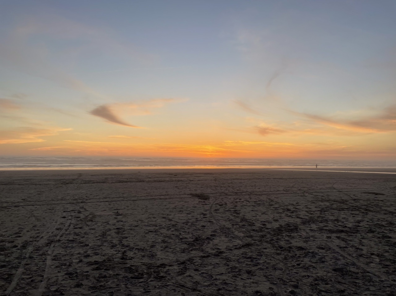
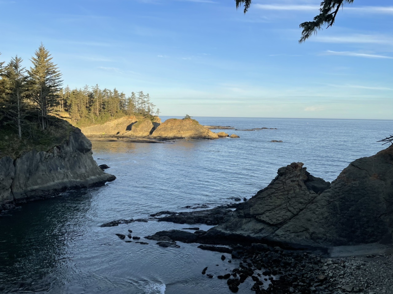
You may recall that by the time we had been in four deserts over two weeks we were ready to be out of the desert. I think it’s fair to say we’ve seen all we came to see in the northwest corner of the country, too. Don’t get me wrong, it’s beautiful here. Spectacularly beautiful in spots. My memory of the trip thus far would rate the drive along the Oregon Coast from Florence to Yachats (it’s pronounced “ya-HOTS”, by the way... no, I can’t explain it... if you see someone on a “yacht” ask them) may be the most scenic 30 miles of the trip so far. For us, the issue has been the relentless chill which has generally been accompanied by grey skies and occasionally rain. Sort of a slightly warmer version of Buffalo... except it’s summer here and I’m recalling my 5 winters spent in Buffalo. The people we’ve met have been warmer by far than the place where they live. They are also a hearty group. Let me turn the clock back to yesterday to illustrate... I’m setting the “way back machine” to Saturday June 5 at 8:09 AM...


So, the day started as we’ve come to expect all summer days to start on the northern Pacific Coast... cold (mid 40’s), heavy overcast, a bit of ground fog and intermittent sprinkles. I believe the other 7 campsites in our loop were occupied by Washingtonians. They were outside, under popup tents that covered their fire ring (a metal device provided at each campsite by the campground operator to contain wood fires that are lit as a quaint tradition by campers in most parts of the country but a life-sustaining necessity here) and the folding chairs they brought. A fire was roaring in each ring and the adults were gathered around it in a pretense of normalcy. Their children were wearing slickers and galoshes and riding their bikes through the campground in the rain. The smiles on their faces suggested a cannabis-fueled effort to enjoy themselves despite the fact that weather just like this killed 1,200 people when the Titanic went down. In fairness, those people were plunged into the water while our fellow campers were being doused... but I submit that is a distinction without a difference. These people were risking their lives for camping!


We left around noon when the faint sun had raised the temperature to 50. We headed east. To get from Cape Disappointment, Washington to Mossyrock, Washington in less than a day you must go through Oregon. So we recrossed the Columbia River and drove along the south bank of the Columbia for about 40 miles. It’s a working area with towns where forest and sea come together. It’s very American with scenes of huge ocean going freighters in the river and factories that handle and process the ever present forest products on both banks. Small towns support the people who manage the interaction of the two.


As we crossed the Columbia to renter Washington the combination of sea and forest was in our faces. A huge Weyerhaeuser mill sits on the Washington side of the river. It’s fed by ships designed solely to transport and discharge trees... not logs... entire trees separated from their stumps and stripped of their limbs. Several ships were docked and working. At another dock just upstream, an ocean going freighter was unloading wind turbine blades. This is a busy place where people are getting things done.


We drove on through an odd mix of sprinkles and sunshine that oscillated on a 20 minute cycle. We passed several signs for Mt. St. Helens. Those of you who were alive in 1980 recall that she blew her top claiming 57 lives, the largest loss of life from a volcanic eruption in U.S. history. I breathed a sigh of relief. I knew we were far enough inland to be out of danger from tsunamis... but unfortunately we had entered the volcano zone. We arrived at our destination which was a campground on a reservoir owned by Tacoma Power and Light. Both the campground and nearby town were named Mossyrock. This is not surprising. We arrived in a rain shower. Everyone who arrived at that campground... ever... arrived in a rain shower. The only thing moss likes better than the north side of a tree is a wet rock. The name fit.


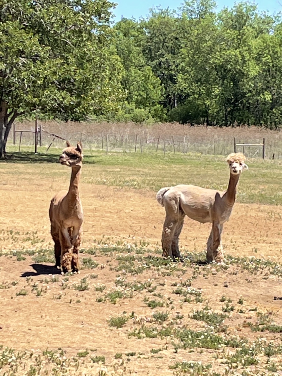
The upside of things being wet all the time is that plants (including moss) thrive. Here are two pics Mrs. C’ took of at random points in Washington State:


Both Saturday night and Sunday morning at Mossyrock the scene we saw at Cape D on Saturday morning was repeated. There were tents, showers, fires, fog, kids, overcast, slickers, cold, galoshes, brief sun, but because we were on a lake there were also people fishing in rowboats. This was two steps closer to Titanic. All the while the people acted naturally, seemingly unaware that in other parts of the country people partake in these same activities all summer long while being warm, dry and occasionally sunburned. This area needs to be studied by a PhD candidate in anthropology... or psychology. The next Margaret Mead would be anointed through the process of documenting and explaining these rituals conducted in such harsh conditions.


Today continued the press east. We drove through the triangle formed by three volcanoes. Mt. Rainer (12,000+ feet) (Mt. Adams (10,000+ feet) and Mt. St. Helens (formerly 9,000+ feet, now 1,300 feet shorter). The view of these three monsters was... absolutely obliterated by the weather. We saw nothing... zip...not a shred of any of them. Here’s what we did see:


We crossed the shoulder of Rainer through White Pass at nearly 5,000 feet above sea level on Rte 12. The road was spectacular despite the weather. Pine trees everywhere, rock faces, cliffs, occasional snow patches, mountain streams that became rivers interspersed with lakes. In two days we will be in Montana which is known as Big Sky Country. This area of Washington should be known as Big Land Country. 


The last two hours of the drive to Moses Lake were in some of the driest looking land we’ve seen this entire trip. The mountains we had crossed have clearly figured out how to wring all of the water out of the air coming ashore from the Pacific leaving none for eastern Washington.


We are camped on a small farm we found through Harvest Host. They hosts are warm and wonderful typical of the folks we’ve met the last 11 days. A start contrast to the weather we’ve encountered. Zach asked if he could stay. We’re thinking about it. Just kidding... Mrs. C’ might leave me here, but Zach goes where she goes. Tomorrow we roll on to Coeur d’Alene, Idaho and then to our campground nearby. I hope you’ll join us!


Later...


Saturday, June 5, 2021

We’ve reached the point of return!

(Written Friday morning, posted Saturday evening)


Good morning, Campers! It’s Silver Cliche’ with you again. Today we are settled at Cape Disappointment State Park in the State of Washington!


Many journeys reach a “point of no return”. That’s not us. We have always intended to return. We even planned for a return. We hope to return enlightened, aware and informed... but returning has always been the goal. Today marks our farthest planned point from home. The trip odometer says 6,035 miles since leaving our driveway on April 16... exactly 7 weeks ago today. This is day 50 of our trip and (depending on precisely when we make our return to Vero Beach) it may be the midpoint on the calendar. It is our “point of return”!


Emblematic of all that, we are clinging to the edge of the continent for one last time. Cape Disappointment State Park is the southwestern most point of the State of Washington. To our west is the Pacific Ocean. To our south is the mouth of the Columbia River and across that, Oregon which we left yesterday after a week. This is the place where Lewis and Clark finished their journey of discovery and made camp for a time. Half the signs around here bear their names... parks, roads, businesses... their trip across the continent is remembered and celebrated more than 200 years later, as it should be. Ours? Probably not that long. I doubt that the nearby town of Chinook, Washington will have a “Silver Cliche’ Elementary School” in 200 years... but it might.


We are also clinging to our connection with the outside world. We are sometimes attached to the Verizon network technically with one bar of service and the lowest signal strength we’ve measured on the boosters and antennas. As a practical matter we are out of communication. It literally feels like we are on the edge of modern American civilization. 100 yards west of here is the ocean. Beyond that? “There be monsters”.


While we have reached many milestones today, what hasn’t changed are the terrain and climate. Yesterday’s trip up the Oregon coast from Tillamook to the state line was cool and mostly cloudy... at times so misty that windshield wipers were needed despite the lack of rain. The parade of small and smaller seaside towns continued. We passed the famous Tillamook cheese-making operation shortly after leaving Cape Lookout. Seeing that facility prompted Mrs.C’ and me to look at each other with awe and wonder and ask “that’s it?”... that small place sends cheese all over the country including to our Publix supermarket in Vero Beach, FL? Our visual calculation showed no drop in the pine tree density and the official Silver Cliche’ weather station showed a high of 65 on our route through Oregon. We crossed the Columbia River on a two lane bridge that was roughly two miles long. When we hit the Washington shore... same. Precisely the same. Cool (61 degrees at 3:00 PM), overcast, piney, small towns... carbon copy of the last five days in Oregon. I almost feel like I should decline the latest sticker, but rules are rules, so here goes...


States visited this trip: 12. New states camped this trip: 4 (NV, CA, OR, WA)

States camped lifetime: 36. New states to go this trip: 12 (ID, MT, ND, MI, VT, NH, ME, RI, MA, CT, NJ, DE)


As for the park, I’ve only toured by foot so far. Just as in Oregon, the beach is populated by zombies. It’s taken me days to figure that out. Just down the street from home in Florida there is a beach and a boardwalk. When you go there you see people running, jumping into the surf, skim boarding, occasionally surfing. They have beach towels and bathing suits in bright colors and apply SPF 50 by the pint. Here... no bright colors... people in hoodies or even full-on coats... walking slowly and up from the water... rarely a person in the surf but if so they are in a black wet suit. Of course, there is a 30 degree difference is water temperature from the eastern Florida Atlantic coast and here in the Pacific Northwest. Maybe the people walking these beaches are thinking “maybe one day I’ll go to Florida to enjoy the beach... until then I’ll shuffle along and look out to sea wistfully”. Part of my enlightenment is the insight that common words like “beach” and “summer” can have vastly different meanings to different people at different places. Despite that, there is strength and beauty here. This pic from the point where one leaves the campground and steps onto the beach nearest our campsite.


There will be a larger version of that scene in panorama format on our Flickr site hopefully tonight but maybe not until tomorrow. If you are a photo enthusiast, don’t forget that Flickr is where the full format shots that are “keepers” wind up. https://www.Flickr.com/photos/silvercliche


So, we’ll hang here today. Tomorrow we head east... inland... toward home (generally speaking). I hope you’ll join us!


Later...

Wednesday, June 2, 2021

The journey has become our life

Good evening, Campers! It’s Silver Cliche’ with you again. Tonight’s report (ed: written Tuesday, finished and posted Wednesday) is being dispatched to you from the foggy, smoke filled campground at Cape Lookout State Park just south of Tillamook, Oregon. This will be our last stop in Oregon and we are in place for two nights. On Thursday we’ll roll north into Washington State.


The good news is that we didn’t need to have slept with our pants and shoes on. There was no tsunami warning last night and there was no tsunami. Mrs. C’ reminded me that I sleep like the dead anyway. The chances of a siren or tsunami waking me were slim at best. You may be asking if I perhaps overstated the risk in my prior dispatch. Moi? Stretch the truth? Here in the land of Paul Bunyan it’s considered honorable to tell a tall tale or embellish stories just a wee bit. However, the threat of a tsunami here is very real. Here is a pic of a sign that was just 100 feet from our campsite last night:


As you can see, we were in the tan section which locals refer to as the “kiss your ass goodbye” zone. By “distant tsunami” they mean that an earthquake in Japan could kill you if you are reading that sign at the moment the sea recedes then returns amplified. You may or may not be better off in the “local tsunami zone”. That area could be inundated by the water that gets energized by a large quake at the Cascadia subduction zone. Let’s do the math on that one... the Cascadia is 70-ish miles offshore. Tsunami waves in the open ocean travel at about 500 miles per hour. That means 70/500=0.14 hours to hit shore. 0.14 hours x 60 minutes per hour = 8 1/2 minutes from the time of the quake to the arrival of a major tsunami. The sign advises evacuation by foot to a specific safe point. Google maps tells us it would take 21 minutes to walk that distance:


So, if you felt the quake, knew immediately what it was and what you should do, and began walking, you would be at the gates of the campground and almost out of the tan zone when a wall of water carried you away. I do not take comfort in the guidance being offered. When I write “The Dictionary of Modern American Communication” I think that sign will be a candidate to illustrate the definition of “false hope”.


So, we closed out our Beachside State Park visit with a chat with the neighbors in the matching Airstream. Nice folks. Enjoying their wedding anniversary at a choice camping spot where they’ve stayed repeatedly over the years in a great camping vehicle. I enjoyed their story to add to the collection of stories from the people we’ve met along the way so far.


We are deep enough into the trip now that some of the philosophical learnings that are being offered may be starting to sink in. We are approaching our farthest planned point from home. We are surrounded now by things we’ve acquired along the way... the food we eat (I defrosted leftover beans and rice we froze in New Orleans for dinner), the clothes we wear (the alpaca socks I bought at Lone Ranch are fantastic in this climate), and the scents we smell (there is a sheaf of French lavender from MoonBeam Farm taped to the range hood). We are in a part of the country (the “left” coast) that I’m told is populated by people who are very different from us Floridians. So far, I haven’t met any Molotov-cocktail-throwing leftists. I think the burning smell in the campground last night was from people sitting by their campfires, not from businesses burning in Portland. I have met a bunch of people who seem to care about the same things Mrs. C’ and I care about... our families, building a life as we age, helping and caring for one another and the amazing places in our country. I haven’t met a single person in 7 weeks (and since I do most of the dog walking and everyone in campgrounds has dogs, I meet and chat it up with a lot of people) who wants to focus on the things we are told define the struggle for the future of America today. It’s not that campgrounds lack diversity. We’ve met (or at least seen from afar) the uber-wealthy in multimillion dollar motor homes, retired folks like us, families tent camping, solo drifters in vans like “Nomadland”, single moms and dads with their kids and several foreigners seeing America (presumably because CNN World Service told them it was coming to an end). I talk with all of them and ti the people who own, run and operate campgrounds, restaurants, gas stations, souvenir shops and all manor of businesses. The evidence of commonality gives me hope that there is a starting point to refocus America on the things we have in common - which are plentiful - even while we look forward solutions to the issues and differences that are featured and highlighted as the existential threats to America.


Phew... you might think I’ve been indulging in locally grown herbal medications... but I actually don’t partake. If I was going to, Oregon would be the place. There is no shortage of opportunity. As I said a paragraph ago, we’ve been traveling far and long enough now that some lessons are starting to reveal themselves like the fog burning off an Oregon beach.


And that’s just where we started Tuesday morning. Here’s a pic of the beach. It was low tide which meant a long walk from the dunes to the surf. People walking at waves-edge were like distant apparitions to anyone who just stepped on the sand.


We rolled out at about noon and headed north. There were a series of towns. They ranged in size from small to smaller. Only Lincoln City was big enough to have a full range of services. The ocean was less visible since Highway 101 is set a bit more inland in central Oregon. At a few points there were bays or inlets, vistas of sandy beaches with breakers and a few enormous rocks the size of 10 story office buildings standing offshore. The Oregon coast has at least a mile or two of every type of seashore we’ve ever visited from the forested cliffs of Maui to Big Sur to the sandy dunes of Martha’s Vineyard. The one it lacks is the sun-baked warmth of Florida... but we know where to find that.


We stopped at Depoe Bay which advertises itself as the world’s smallest navigable harbor. I didn’t bring a drone (ok... I don’t own a drone) so I borrowed this pic from Wikipedia:


That’s it... 100% of Depoe Bay and its 1,300 inhabitants in one picture. It was a fascinating and worthwhile stop. We ate fish and chips and a “potato tornado” which was like a continuous potato chip on a stick:


One thing I can say about every seaside tourist town we’ve stopped at... you never leave saying “I didn’t get a chance to eat as much fried food or sweets as I hoped to.”


We went whale watching (unsuccessfully) at the town’s whale observatory. That’s the building just to the left of the harbor entrance in the pic above. There is a pod of resident grey whales that live offshore from June to September. We could see commercial whale watching boats and a few private craft about a mile out. Presumably they were where the whale action was. The only whale action we saw was around fried food and sweets (sorry, Doc... I said I usually lose a few on these long trips... not in Oregon it turns out).


Then we linked up with the dogs who had stayed in the Airstream. On a Tuesday in early June we found a suitable berth for the rig right in the busy part of town. 


We reached Cape Lookout at about 4:30, fed and walked the dogs on the beach including some free time on a 5 mile long off-leash beach that begins at the campground. They were only good for 1/4 mile of it, but it was their first off leash time since California.


Wednesday is a down day. Thursday it’s on to Washington State. I hope you’ll roll along with us!


Later...

Tuesday, June 1, 2021

If the siren sounds... run!

Good evening, Campers! It’s Silver Cliche’ with you again. Tonight we are safely camped at Beachside State Park just outside of Yachats, Oregon. 

My first challenge of the day is that I don’t know how to pronounce “Yachats”.  It might be “YACH-ats” or maybe “YA-chats” or perhaps the second “a” is silent and it’s the single syllable word “yachts”. How that word mutes the sound of so many consonants is another mystery. Let’s not get started on that.


Oregon, Oregon... let’s get back to Oregon. Today was a short drive as will be tomorrow. Less than 100 miles from Coos Bay to Yachats. By reputation, Highway 101 which carried us that distance is one of Oregon’s beautiful drives. In reality, half of it is a slow crawl through the woods in heavy Memorial Day traffic and half of it is a spectacular drive. Let’s take those in order.


The drive from Coos Bay to Florence is about 50 miles of 2 lane road. Today is Memorial Day and the throngs of people who escaped Portland and Eugene and God knows where else for the weekend were headed home. We slipped into their crawl. Our Florida plates and northerly compass heading told everyone that we were heading away from home but that bought us nothing. There was occasional evidence of natural beauty but it was distant or fleeting. Much of that drive is through the Oregon Dunes Recreation Area. When we saw dunes at all it was the backside of them. Presumably the beautiful side faced the Pacific which was usually some miles to our west. We occasionally crossed bays, rivers or inlets. One was large enough to have a large U.S. Coast Guard vessel underway within our view. Others had more massive log piles beside forest products factories. Still more had commercial fishing boats at dock. None had that “In your face, Floridian!” beauty we hoped to find. The highlight was when Google maps said “I can save you 2 minutes by getting out of this traffic and onto a parallel road.”.  We passed within about 100 feet of one of the many old light houses that dot the Oregon coast. Mrs. C’ got the shot!


We stopped for a bite, stretch, and a little shopping in Florence, Oregon on the Siuslaw River. Don’t ask me exactly how to pronounce that, either. I think it’s like saying “cole-slaw” with a mouth full of coleslaw. It was 64 degrees and mostly overcast but with enough sun coming through to make it feel like 66 degrees and overcast. The Oregonians were eating at outdoor cafe’s and celebrating Memorial Day’s place as the start of summer. We Floridians have a word for a day that’s overcast with a high of 64... winter. We ate our take-out in the Airstream with the furnace on and left. I caught this uninspiring picture of the Coleslaw River Bridge in natural light to memorialize the start of summer in coastal Oregon. The people we met seemed upbeat and cheery. I’m figuring they are all on antidepressants. Also, recreational marijuana is legal and evident here.


We gassed up before leaving town. Have I mentioned that Oregon has a state law prohibiting pumping your own gas? Evidently, they feel this is a task, like performing an appendectomy or installing natural gas lines, that should be performed only by trained professionals. It adds time and unwanted interpersonal interaction to a task that’s tedious enough. Plus, it raises the question of tipping. I didn’t tip the surgeon who removed my appendix. I don’t tip the nozzle jockeys either. I hope I’m not being an ugly Floridian.


Then it happened. We entered a time machine and were two weeks back on the California Coast at Big Sur... only maybe a bit better. The coast between Florence and Yachats is spectacular. The shoreline itself is a variety of forms from broad sandy beaches to weathered sedimentary rock which is deadly steep in some places. That forces the pine forests to contour their approach to the waves from a respectable distance in some areas which offers long views of the surfline from Highway 101 to almost in the waves in others. Driving this stretch is a constant game of “I wonder what’s next” as each turn in the road approaches for almost 30 miles. And there are plenty of turns. Hills, too. Like California 1 at Big Sur, Highway 101 is forced to climb to serious elevations in short distances then drop again in order to find ground that can hold it. I would love to tell you that I checked my altimeter and it showed 600, 700 or 850 feet above sea level at one point but the combination of steep hills, frequent switchbacks, narrow lanes and an 8 1/2 foot wide trailer made that unwise. Even if I thought the odds of surviving an elevation check were worth it, Mrs. C’, Zachary and Romeo were watching me like a hawk for any sign of distraction or impairment. I think Mrs. C’ had her right hand on the door handle and her seatbelt unbuckled st one point but I’m not totally certain about that. The exclamation point on the beauty of this drive was the Heceta Head lighthouse. It’s cluster of brilliant white buildings with red roofs is visible from a high point of Highway 101 as you round a bend and look across an open bay to the cliff side spot that was carved out for them. The final test of trailer-towing acumen is a short, narrow tunnel with a curved roof and two clearance signs... one for the left side of the lane and a lower one for the right. It’s like staring down Clint Eastwood after a few rounds have been exchanged and he asks if you are feeling lucky. “You know you’re not 14’6” on the left... but are you under 11’6” on the right?”. I called his bluff and won... this time. The downside of this drive is that the scenery changes too quickly to photograph from a moving vehicle. There are viewpoints and turnouts, but they are all on the ocean side of the road. That’s great for a Prius or motorcycle skipping along southbound. Pull over... snap, snap... scoot off. Not so good for the USS Airstream needing to cross the centerline... call for tugboats to slip into a tight berth... unship the camera gear from the trailer and reverse the process to resume navigation. So here’s a suggestion if these words are not enough... Google “Highway 101 central Oregon”, go to “images” and you’ll see what professional photographers have done to earn a living on this amazing stretch of coast. 


I piloted the Airstream into Beachside State Park at about 5:30. A quick walk-around didn’t identify any new scratches or body damage. Mrs. C’ did yeoman’s work making sure I didn’t knock anything over while backing the beast into her resting place for the night. Our spot is on a rise directly above the beach which is about 200 yards wide from the dunes to the surf. Here’s a pic of us settled in taken from the beach below:


Ok... I lied... that’s not us. It happens that the very best spot in the campground is occupied by a 25’ front bedroom Airstream... same as us. That’s a pic of him. Our spot isn’t too shabby... we are immediately next to him. You can actually see the white roof fan and silver front end of out Airstream in that photo just to the left of our neighbor.


As the sun set I walked the dogs on the beach and captured this about 100 yards from our trailer:


Oh... and that part about sirens? Well, offshore from this part of the Pacific Coast of Northern California, Oregon and Washington is a flaw in the earth’s crust known as the Cascadia Fault. You know, like the San Andreas Fault... but underwater. The geologic records make it evident that every 300 years, give or take, this beast burps and drives a massive tsunami on shore. Native American lore supports this as a recurring theme of destruction. It’s been about 400 years since the last burp, so the people of Yachats and other unpronounceable towns up and down the coast have prepared themselves with alarms and evacuation routes. I’m not saying we are concerned about that. I’m just saying the truck is still fully hitched to the trailer and I’m sleeping with my pants and shoes on. 


Tomorrow is another short drive then we settle in place for our last two nights in Oregon. After that we reach our farthest point from home... Cape Disappointment, Washington. I hope you’ll join us! You won’t be disappointed. (I’m sorry... I feel cheap and dirty for having written that. Proud, too, of course... but in a cheap and dirty way.)


Later...


Monday, May 31, 2021

Layin’ low in Oregon


Good morning, Campers! It’s Silver Cliche’ with you from Sunset Bay State Park in Coos Bay, Oregon.

This will be brief. We did precious little yesterday and have only a bit of bandwidth here.

Evidently, they call this “sunset” bay because it was named by a landscape photographer. I posted sunset pics from Saturday. Yesterday I took two long hikes to other parts of the park in daylight hours. Not much to show for it. 

This morning the pre-sunrise temp at the Silver Cliche’ weather station was 48 degrees but it was looking clear (a rare thing on the Oregon coast... evidently we just caught the beginning of the good weather here!). I grabbed my gear and headed out. It’s a beautiful spot in any light, but the dramatic, brilliant sunset shots win. Nevertheless, here are two fresh pics for you in this morning’s early light.


Today we will roll north couple of hours and tomorrow the same. For the next five nights we are at state campgrounds on the Pacific. Two spots for three nights in Oregon then two in Washington State... our farthest point from home!

I hope you’ll roll along with us.

Later...

Saturday, May 29, 2021

Is that picture April or August?

Good evening, Campers! It’s a tired Silver Cliche’ with you again tonight and tonight we are in Coos Bay, Oregon. Specifically, we are at Sunset Bay State Park. Coos Bay is about 1/3 of the way up the coast of Oregon from the California state line to the Washington state line.

I’ll keep it brief because we had a long day. It’s about 4 1/2 hours of driving from Fort Klamath to here as the Corvette flies. 5 1/2 as the Airstream loafs. To break up the drive we made two planned stops. I’ll talk about those in a minute.

The view out the window today for the entire trip looked like the monthly pics from the wall calendar of a chainsaw company, sometimes the pine trees were in the distance with beautiful farms and snow capped peaks:


Thanks to Mrs. C’ for that pic! Other times they were in your face like this shot:

It was a day filled with natural beauty. The constant was the trees. The trees, trees, Trees TREES! Enough with the snow capped mountains, withe water rapids, scenic vistas, curving mountain roads and rocky outcroppings. We get it... Oregon is a state of endless rugged natural beauty. And the smell of pine? The last time I experienced that intensity was when I knocked over an uncapped bottle of Pine Sol in a small bathroom. Enough already. Don’t you have any ghetto neighborhoods, junk yards or half empty strip malls here?

We broke up the trip with two worthwhile stops. The first was to meet Richard and Renata at their farm Alpacas at Lone Ranch. We connected with them through Harvest Hosts. They graciously offered to have us visit even though we were not staying the night. What a lovely couple and what amazing animals they raise. They had probably 30 alpacas ranging in age from a few weeks to 20 years. The alpacas range from a light tan (almost white) to black. Several were a “sequoia bark” cinnamon color. We clearly had a lot in common with Richard and Renata and as a result we took up far too much of their time talking about similarities in our lives and viewpoints. If we every make it back to southern Oregon (how hard could that be... we are only 5,400 driving miles and 6 weeks from home!) we are sure to ask them if we can come back and maybe shovel alpaca poo to help repay them for the time they took to allow us a glimpse of their corner of America. Here are a couple of shots of the alpacas at Lone Ranch.


Thank you, thank you Renata and Richard! We were so impressed with the business and life you have created at the ranch and by the amazing animals you raise and care for there! If we make it back we’ll bring our own shovels.

Another 45 minutes ahead we stopped at a legendary I-5 institution, the modestly named bakery and restaurant “Heaven on Earth”. They are known for their cinnamon buns. They come in various sizes from extra large to the size of a garbage can lid. Clearly they know their customer. Between the front door and the hostess stand here’s what’s waiting for you.


We rolled into Sunset Bay at about 5:30. I did get a chance to walk with the dogs and snap some pics. Here are two that are badly copied from the larger versions which are available on Flickr at https://www.Flickr.com/photos/silvercliche.  Check out the real ones!


Ok, that’s it. I’m beat... need some shuteye. Tomorrow we’ll kick around Coos Bay. Come back to see what we learn, see and do!

Later...