Good evening, Campers! It’s Silver Cliche’ here with you again. Tonight we are camped at the San Luis State Recreation Area just outside of Santa Nella, California on the western side of the San Joaquin Valley.
After yesterday’s windstorm on Monterey Bay things settled down overnight and the temps plunged. The Silver Cliche’ weather station clocked a brisk 39 degrees just before the sun started to warm things. Forecast high in Watsonville today... 62. Which is the same thing our digital speedometer read as we said “let’s blow this town and find a warmer one!”
Our exit took us through some interesting stuff. First, Mrs. C’ caught this pic of an unusual house which we first saw on the way in to Sunset State Beach:
A little Googling told us the story. Built in the 1890s, the house was sold to a Japanese-American farmer in the 1930s. Evidently, the population of the Pajaro Valley was about 10% people of Japanese ancestry at that time. U.S. citizens, but descended from Japanese immigrants. Then WWII came with the opening shots fired at us (you may recall December 7, 1941... at date that will live in infamy) by non-U.S. citizens of Japanese ancestry. Well, the U.S. government got confused since they all looked about the same to people from Washington, so they rounded up these citizens (including Mr. Hirahara and his family) and sent them to Arkansas for the rest of the war and took their property for good measure. I’m thinking people in other countries know this history when Americans preach about the abuses they commit against their citizens and demand that it stop based on all things that are moral, good and American! Sorry... I got a little carried away... let me stow my flag. Anyway, local folks in Watsonville somehow helped the Hiraharas return to the house after the war ended and the U.S. government ended their Arkansas vacation. Eventually the house was abandoned by the family. Again, local folk got involved and before a developer could build a 7-11 or something there they got the house accepted in the National Register of Historic Places for its architectural significance. Development prohibited! For me, this story is about a lot more than architecture. Ya gotta stumble on this stuff to hear these stories... or know someone who does.
On we rolled past strawberry fields (in Salinas it’s “Me and Bobby McGee”... in Watsonville it’s “Strawberry Fields Forever”) then we saw acre after acre of fields covered by plastic that was draped over semicircular arches. Each arch was about 25 feet wide at the base and 15 feet or so tall at the center. Inside were rows of plants that looked like grape vines. There was space between each row, a post at each end and, I presumed, a wire between each post to allow the plants to be supported. I’ve never seen covered vineyards. Why here? Again, Google provided the answer. Watsonville is home to Driscoll’s berries. Maybe your grocery stocks them. Ours does. At this time of year their farms in Watsonville produce strawberries (I showed you that last night) and... wait for it... raspberries and blackberries. Eureka! (That’s eureka the exclamation... not Eureka the city in Northern California). These were field of raspberries and blackberries. I feel a growing connection to Watsonville. These people have been making my breakfasts and desserts more colorful and delicious for most of my life.
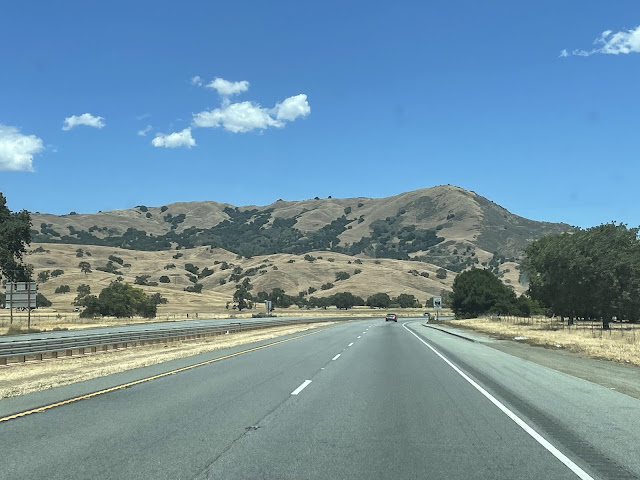
So we rolled east through beautiful rolling hills covered with parched grasslands. We went through Gilroy, the garlic capital of the U.S.. it truly smelled of garlic there... I mean the town smells like it ate a salami sandwich on garlic toast.
As we approached our current campground we skirted the San Luis Reservoir. It looks like other California lakes and reservoirs we’ve seen so far... way below capacity. We saw herds of elk on the hillsides above the reservoir. We continued another couple of miles and turned off the main road to get here. The campground is located on a “forebay” to the reservoir. This is a smaller reservoir fed by the larger one we had passed. It’s a holding pool before distribution and it appears to be filled. From Google Maps I can see that water is distributed from here through three channels that head in various directions.
As I walked the dogs after dinner I got a couple shots if the forebay including one of four deer just behind our trailer and campsite.
We plan to spend three nights here while it rains and gets cold in Yosemite. We are both feeling some effects of the pace of travel and relocating so often. Maybe 4 months to survey our border should have been six. Anyway, we are here now, it was 77 degrees, dry and sunny today. It’ll be nice to chill a bit.
Later...


No comments:
Post a Comment