Good evening, Campers! It’s Silver Cliche’ with you again. This is night three and our final night at the Crater Lake Resort. We have a big day planned for tomorrow as we head to Coos Bay, Oregon on the coast. Before we head off wanted to share the amazing day we had today.
It was chilly this morning. The official reading from the Silver Cliche’ weather station at 5:30 AM was 33 degrees outside. Thanks to the propane furnace in the Airstream it was a delightful 68 inside.
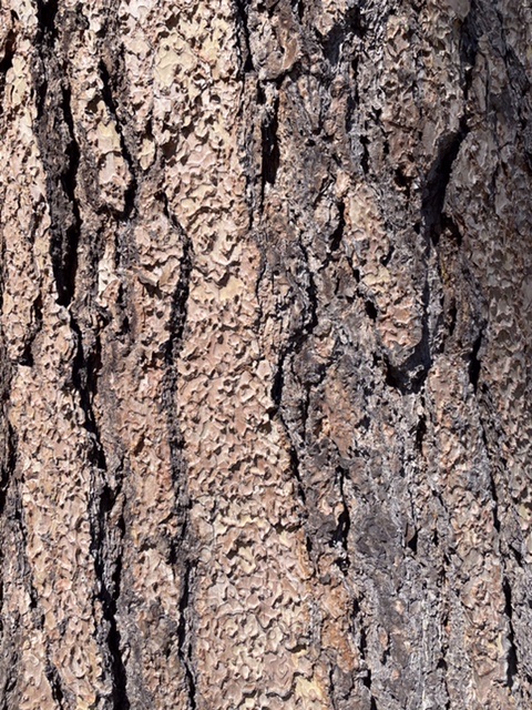
The dogs and I took a walk around the campground after breakfast so they could water the trees and I could practice identifying them. Their skills are sharper than mine. They get every tree and I’m not sure I’ve gotten any. Take this specimen, for example, I’m thinking it’s some kind of pine... or maybe it’s a fir. It’s hard to say.
I figured a close up might help, so I moved in.
I’m still not there. I’d better get a book. Or maybe a “conifer coach”. If there is such a thing this is the place to find one. There are only about 10 billion trees in Oregon. This might take awhile. Just as we tired of the desert, I may eventually tire of pine trees. But not yet.
So, frustrated by efforts at forestry, we decided to try something where our skills have been proven... visiting a National Park. Conveniently, there was one just up the road. Even more conveniently, our decision to do chores yesterday and see Crater Lake National Park today had paid off. The day was crystal clear, warmer and nearly dead calm. Ideal weather for park touring. Here is a shot of a random section of the road into the park. It’s typical of this part of Oregon and unremarkable in most ways except for a small detail which is the presence of sticks standing like 15 foot tall, rail straight, branchless trees with two reflectors at the top. This is the road that the National Park Service maintains open in the winter (most of the park roads are still not open and it’s Memorial Day weekend). This area gets over 10 feet of snow in a typical year. Those small trees are the roadside markers for the snowplow drivers.
You may be saying “Crater Lake... Crater Lake... what’s the big deal about a lake... we have lakes where I live, too.”. If you are, then cut it out... especially if you said it with a snotty, sing-songy voice. You don’t have a lake like this where you live. Generally if you want to find a lake you look downhill. The reason for that is simple. Water flows downhill. Lakes are full of water. The water got there from somewhere higher. In Crater Lake’s case, to find the lake you must look up. Our campground is at about 4,000 feet above sea level. Nearby Upper Klamath Lake is at about the same. Crater Lake is about 20 miles north of here and it’s water level is at 6,100 feet. You see, Crater Lake isn’t a lake at all. It’s a volcano that blew its top, left a big empty bowl where lava and mountain used to be and that bowl filled with water to its current level. There’s room for more water but as you’ll see in a moment that would spoil the pictures.
A volcano? Yes. A volcano. I can hear the wheels turning in your head. “So, Silver Cliche’ how many millions of years ago did this “blow up” occur?” Let me tell you... it’s thousands, not millions. 7,700 years ago. It’s so recent that archaeologists have found evidence that native people saw the blast. I suspect that the Klamath tribe members and others (or even their predecessor tribes) called that event “a very bad day to be in Southern Oregon”. There are many volcanoes in Washington, Oregon and Northern California. Mount Shasta is one. Crater Lake is the site of one that has been posthumously named Mt. Mazama. You may recall Mount St. Helens that blew in 1980, killing 57 people. Here is a map showing the names of the volcanoes that align with the Cascade range.
https://prd-wret.s3.us-west-2.amazonaws.com/assets/palladium/production/s3fs-public/vhp_img1184.jpg
It’s clearly not over. There have been scores of eruptions among those peaks in the past few thousand years. There will be more.
While I’m sure many geologists and volcanologists come here to study what happened, most visitors (including Mrs. C’ and I) come to witness the aftermath. Before I share a few shots, let me cover a topic I should have covered sometime ago. Scale. You may be tempted to look at the pics below, or better yet, the full size panoramas on Flickr (at https://www.flickr.com/photos/silvercliche) and say “Wow... beautiful... I feel like I’ve been there”. You haven’t had the experience of being here. The thing that you can’t get from even the clearest picture on the best day for photography (you’re welcome) is a sense of the size of this place. The lake is between 4 and 6 miles across. The rim of the volcano/lake is anywhere from 500 to almost 2,000 feet above the lake level. The lake itself is the deepest lake in the U.S. at over 1,900 feet deep. This lake invented “supersizing”.
So... the pics
We wrapped up at the park, headed to Klamath Falls for some reprovisioning and settled in to the trailer hood for dinner and dig-husbandry.
Tomorrow will be a long day including Alpacas, cinnamon buns and the Oregon coast. I hope you’ll come along!
Later...


No comments:
Post a Comment